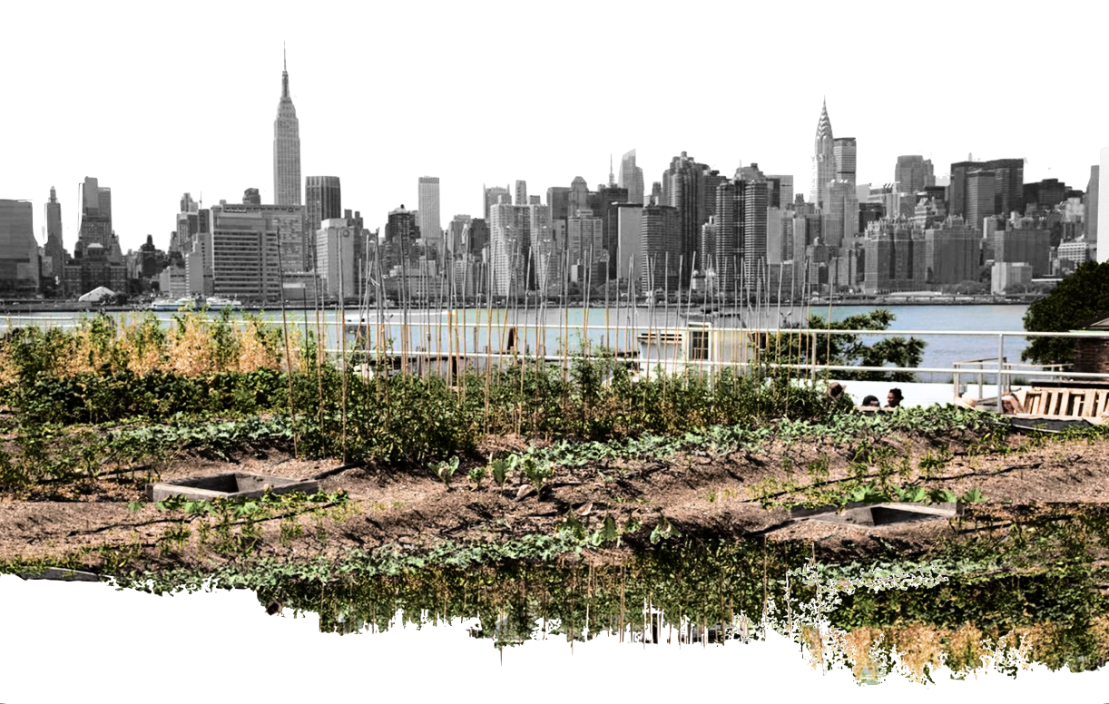
The City as a Farm
How can urban agriculture help address food insecurity within New York City?
Letti Campo
MS Computational Design Practices, 2023
Columbia University GSAPP
Outreach
Methodology
The Little Apple
Limitations & Implications
Urban Agriculture Resources
Modifying The Little Apple
NYC 3D Models for Use
Sources
Background
This project is founded in a love of food, as well as a profound respect for the multiplicity of food. Food is so many things: food is culture, food is community, food is nourishment, food is resistance, and food is power. And the greatest power of food is that it empowers us to take advantage of all of the things that food is such as celebrating our culture, connecting with our communities, feeding our bodies and souls, and standing for what is right. This is why food, and as an extension food access, is just not a necessity for survival, but a necessity for positive growth on both micro and macro levels.
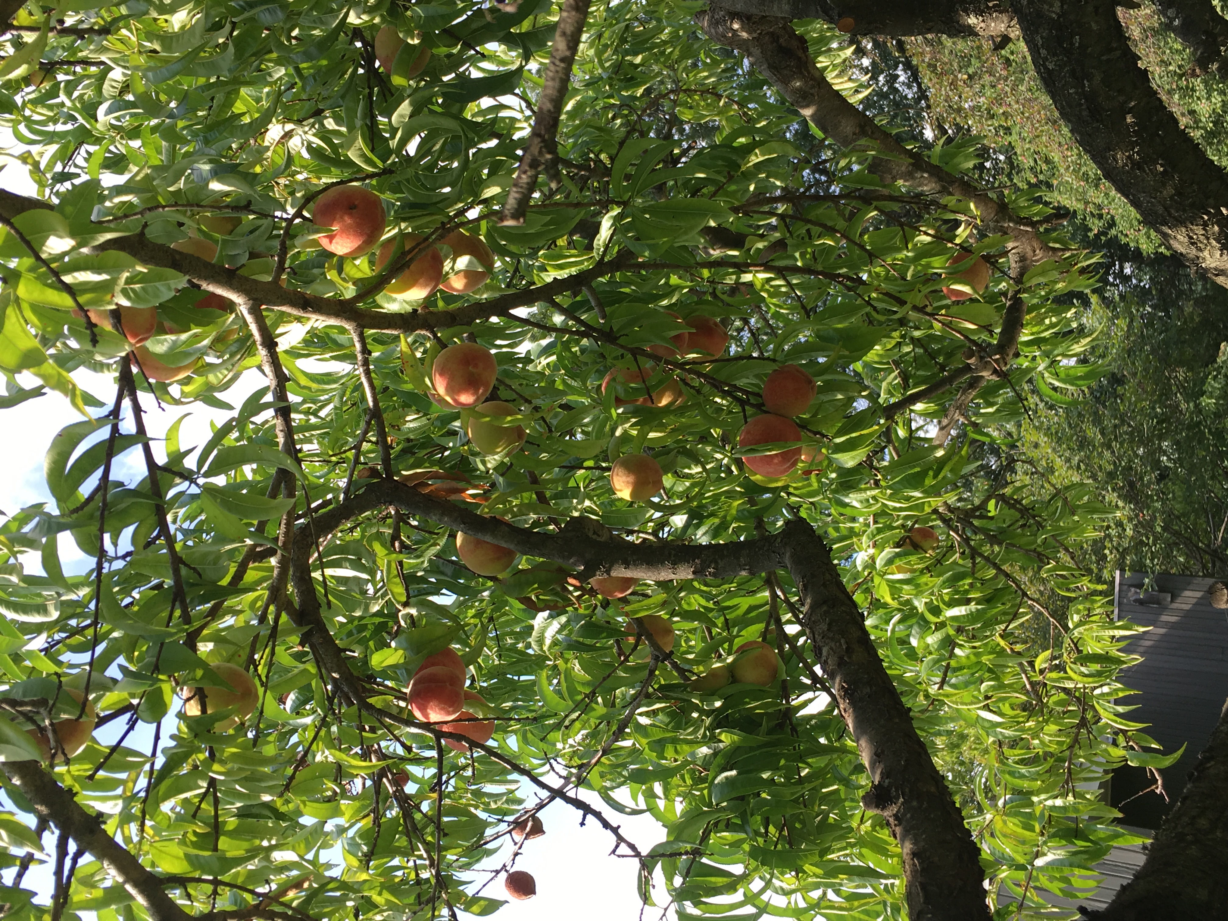
I have fortunately known the power of food and food access intimately since I was a child growing up in Pittsburgh, PA where we had two fruit trees in our backyard. These trees were foundational in developing my love for making pies, as an endless supply of crabapples and peaches begs the question of what to do with them. Believe me... I'm not just saying this, I actually now have a tattoo of a piece of pie on my wrist.
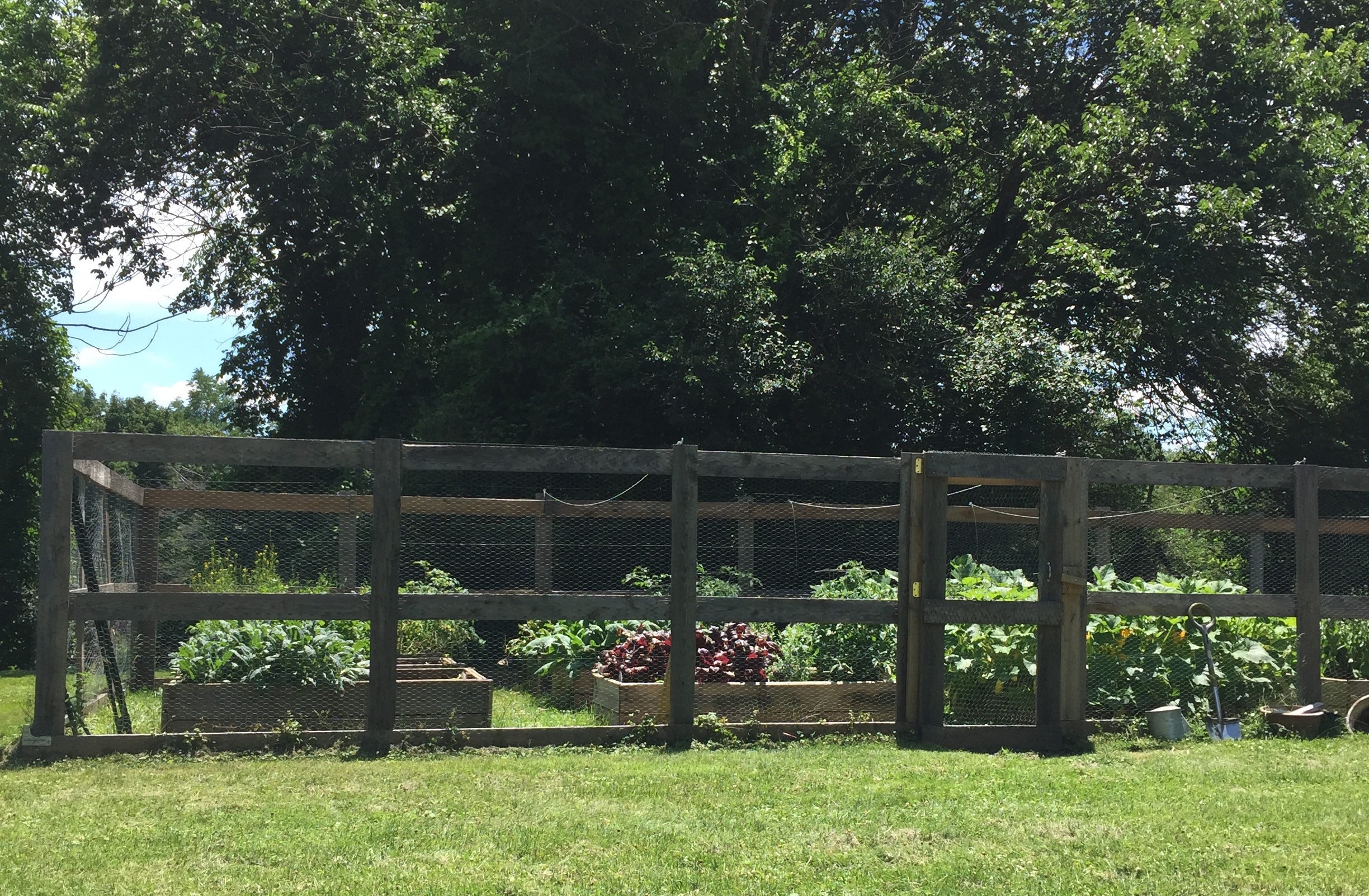
But that wasn't it either. When I was in high school, my mom set out to add a garden of raised beds among our fruit trees, and in that garden she went on to grow copious amounts of kale, zucchini, squach, blueberries, and so much more. It is because of the access that I had to all of these fresh foods that I was able to explore them and learn how to prepare each item, developing my tastes as well as my ability to cook. Now, access didn't gaurantee that I developed a love for all foods (swiss chard is still a vegetable I would rather avoid), but I am sure looking back that there are some foods I would have never grown to love had I not been able to simply go out and pick them from my backyard.
So what?
So, I say all of that because I know how easy it is to take food for granted. In New York City alone, it is estimated by City Harvest that there are 2.4 million men, women, and children who are struggling to make ends meet, with 1.5 million of those individuals being "food insecure".1 For context, that accounts for more than 16% of the city's total population, meaning that 16% of New Yorkers lack access to the power of food.
Upon discovering this, I set out to learn more about our food system, which led me to the Hunts Point Distribution Center, whose sales account for around 60% of the produce sales within New York City per year.2 Having a central critical distribution center such as this poses a clear threat to our city's food supply, as any event preventing the Center's ability to serve the city would immediately eliminate more than half of the city's fresh food. And that's not even considering that a significant amount of our population is unfed regardless.
So I turned my focus within the city. I looked into the Hyper Local Food Movement, which has been making great strides in large yet notably less-dense cities such as Portland, ME and Washington, D.C. This movement boasts advantages such as:
- Adding variety to your diet with fresher food;
- Addressing food insecurity within cities;
- Cutting transportation costs;
- Supporting the local economy; and
- Tastier food thanks to organic and eco-friendly farming practices.3
Is this even possible for a city like New York City? What are the true implications of hyper-locality on the scale of a city as dense as New York City? Would a hyper local New York City actually bring positive change? And is it even possible for New York City to become significantly hyper local to the point where it would positively impact our food system?
Outreach
To make sure that my approach to this project was grounded in the realities of urban agriculture, and to support realistically actionable results within a regulated urban environment, I made an effort to connect with several individuals who could speak to their experiences with urban agriculture programs across the East coast. These insights are integral to the foudation of my project, and I include them here for further reference.Government Officials
It turns out that I'm not alone in having questions surrounding urban agriculture with New York City, as Mayor Adams announced the Mayor's Office of Urban Agriculture in September 2022 with the goals of "expand[ing] the supply of healthy and locally grown food, creat[ing] jobs, and mak[ing] our city more resilient".4 While I was unfortunatley unable to meet with a representative from the New York City Office of Urban Agriculture, I was fortunate to speak directly to members of the Portland, ME and Washington, D.C. urban agriculture programs.
In Portland, ME, the city contracts Cultivating Community5 to run their farming programs. Through these programs, Cultivating Community provides locations for community gardens where the soil and air quality have been tested and remediation has been performed if necessary. These locations also are provided with fences, water (which is turned on and off by season), a tool shed with communal tools, and a composting area.
In additon to size, locations which serve communities that are most in need of food access are prioritized, and the distribution of development grants helps facilitate that process. Cultivating communities currently only puts gardens into existing parks and open spaces, and they have found great success placing community gardens next to athletic fields given the amount of sunlight and open space required to place such a space. All locations feature in-the-ground soil farming.
Participants pay for a garden plot or half-plot via a yearly fee for which there is a sliding scale and scholarship opportunities if needed. If you are fortunate enough to be able to afford more, you are encouraged to contribute in support of the success these programs. In addition, all participants are required to volunteer six hours a season to help maintain the garden. This volunteer work includes things like flipping the compost, organizing the toolshed, and assisting other gardeners.
Community-based models and participations are encouraged by Cultivating Communitites. In one garden, there is a common share model where the work is divided evenly between several individuals rather than a by-plot basis. This model allows participants who are new to growing food or new to the area to learn about urban agriculture and become more immersed in their communitites. In all gardens, individuals are encouraged to donate a portion of their crops for nonprofits and food banks, and there is a cooler at every garden where these organizations pick up food for their missions.
You can grow more than you think in a single plot. Every year, Cultivating Community distributes a survey to ask how much food each participant grew and how their participation affected their family's ability to access food.
Overwhelmingly they receive positive results wherein participants report that the program has allowed them and their families to include more vegetables in their diet at a reduced rate.
In Washington, D.C., the Office of Urban Agriculture is held within the D.C. Department of Energy and Environment. As of today, there are 214 urban agriculture locations within the District, with the vast majority being urban farms. These locations are offered through a regular lease program with utilities, although in some cases locations on park land might have water fee subsidies.
The most important metrics when assessing potential locations are water access and light access for crop yield. Each lot has the soil tested to ensure viability before it is offered for lease, but utility and water lines are not included in every location and need to be installed to ensure successful crop yield. This can be a significant amount of work on the applicant, which has been known to affect who can become an urban farmer, but programs are continuing to be put in place to ameliorate this.
All urban farms in Washington, D.C. are individually managed, and the majority of participating farmers have been working in the space for over 10 years. This has allowed the District to develop a robust network of urban farmers, which is extremely beneficial to the overall success of the program. The long-term goal of the program is to help build resources for urban farms and agriculture. Current programs in support of this support this goal are:
- An annual grant program
- A tax abatement program
- The Land Lease program
- Rooting D.C., a yearly urban agriculture conference
The majority of successful farms are owned on district-owned park land. Because for-profit organizations cannot profit off of government owned land, these farms are primarly nonprofit. Some notable feedback that the program has received is that when parcels of land embedded in residential neighborhoods weren't first offered to the residents for participation, the community rejects the urban farm.
In the future, including community members within the process of establishing these locations is a priority in order to ensure equity and respect for a community's interests.
Community Members
I had the immense pleasure of attending this year's Rooting D.C. conference, which afforded me the opportunity to meet with community members and urban farmers within the D.C. area who could speak to the benefits and drawbacks of the city's programs. Overwhelmingly, the focus was on empowerment. Drawing on the history of urban farms and gardening, participants in this conference reflected on how growing your own food has been used as a form of resistance in the past. But when community gardens became trendy in the 2000s, the friction between trend and need forced many necessary urban agriculture locations to pivot towards the trend and away from survival.
And when the trend faded and participants dwindled, there was no more food being grown in these locations. Now, as urban agriculture is returning to the urban environment, facilitators have the opportunity to reposition their approach to implementing these programs. For them to best succeed they need to center communities and community members, and ask the important questions such as: Do you want a farm next door?
On a policy side, land access is the key issue for prospective urban farmers. Despite the programs such as the USDA urban agriculture funding grants and land lease programs, it is difficult to understand the process from the outside and get your foot in the door. The time that it takes to apply for these programs translates into money, which only further imbalances the equity of who is able to become an urban farmer. However community members are willing to see this through, and hopeful that these programs will continue to be expanded and resources will continue to become more readily available to support this process.
From a social standpoint, who grows the food matters. When community members are empowered to grow their own food, they are able to include culture on the menu. Additionally, when community members are in charge of their own food system, they dont need to fear that it may suddenly disappear without notice.
In all of these conversations, the takeaway was clear: Communities need to be empowered to grow their own food not just to provide nourishment, but to allow them and their members to truly harness all of the powers of food within their own cultural narrative.
Methodology
This project aims to support the future of urban agriculture in New York City by giving community members the ability to explore the possible locations for urban farms and communnity gardens throughout all five boroughs. Furthermore, it is my goal to center the mission of addressing food insecurity within this project to ensure that future locations are prioritized where they are needed most. With this in mind, this project seeks to answer the questions:
What would the total possible output of a hyper-local NYC be, and where could this be implemented within the city? What would the city need to sacrifice in order to achieve this? At a minimum, could a hyper-local New York City help significantly combat food insecurity within the city?
Listing Potential Locations
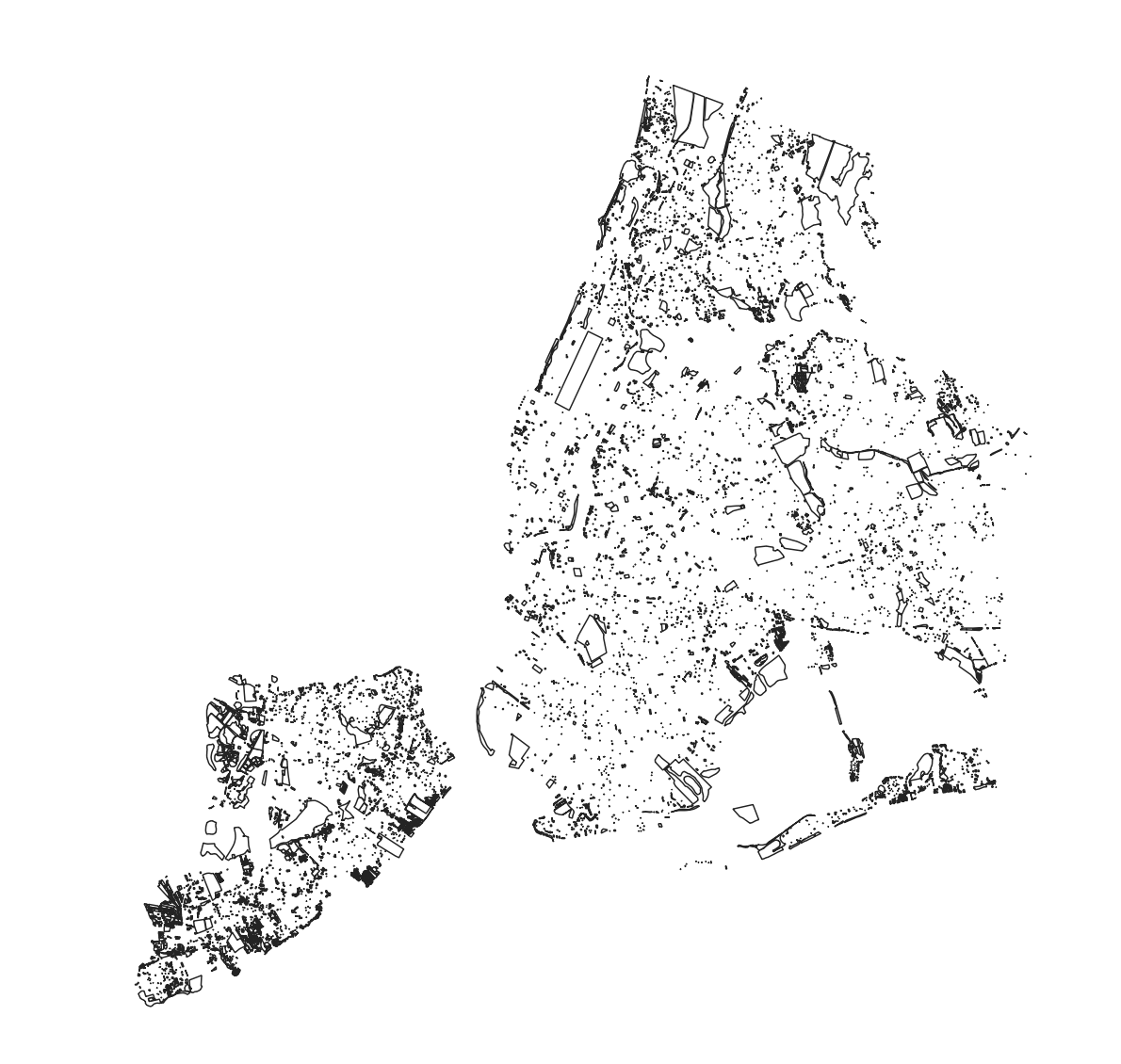
First and foremost, I needed to develop a dataset of potential locations for urban agriculture witin New York City. I began by looking at the dataset referenced on the Office of Urban Agriculture's website: "City-owned sites that are available and potentially suitable for urban agriculture" available on NYC Open Data.6 Disappointingly, there were only 29 potential locations on this list.
Instead, I developed a dataset of my own. Using PLUTO data, I compiled the locations of all of the vacant lots, open spaces without recreational facilities, and unlicensed parking lots throughout the five boroughts of the city.7 Through this preliminary dataset, I ended up with over 8,000 potential locations accounting for more than 30,000 acres of lots potentially suitable for urban agriculture throughout the city.
Adding Corresponding Metrics
To make the best assessments for potential locations, I needed to determine which metrics were necessary for evaluating each lot for urban agriculture. For this, I relied on the insight I received from the individuals which whom I spoke as well as my own personal experience with growing . As a result, I was able to finalize my metrics list to the following:
- Area: this data was a simple feature calculation done in QGIS. I first calculated the area in square meters which was the dataset's unit of measurement, and then I performed simple math to convert it to acres. These locations were then filtered to only include those greater than or equal to 0.1 acres in order to ensure that they would serve enough individuals to justify their implementation.
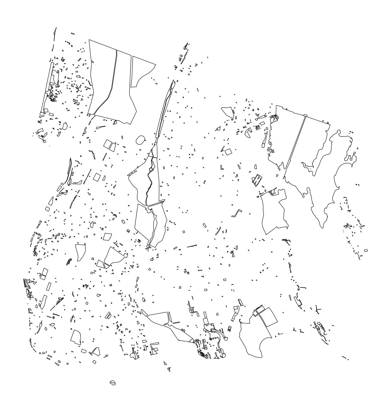
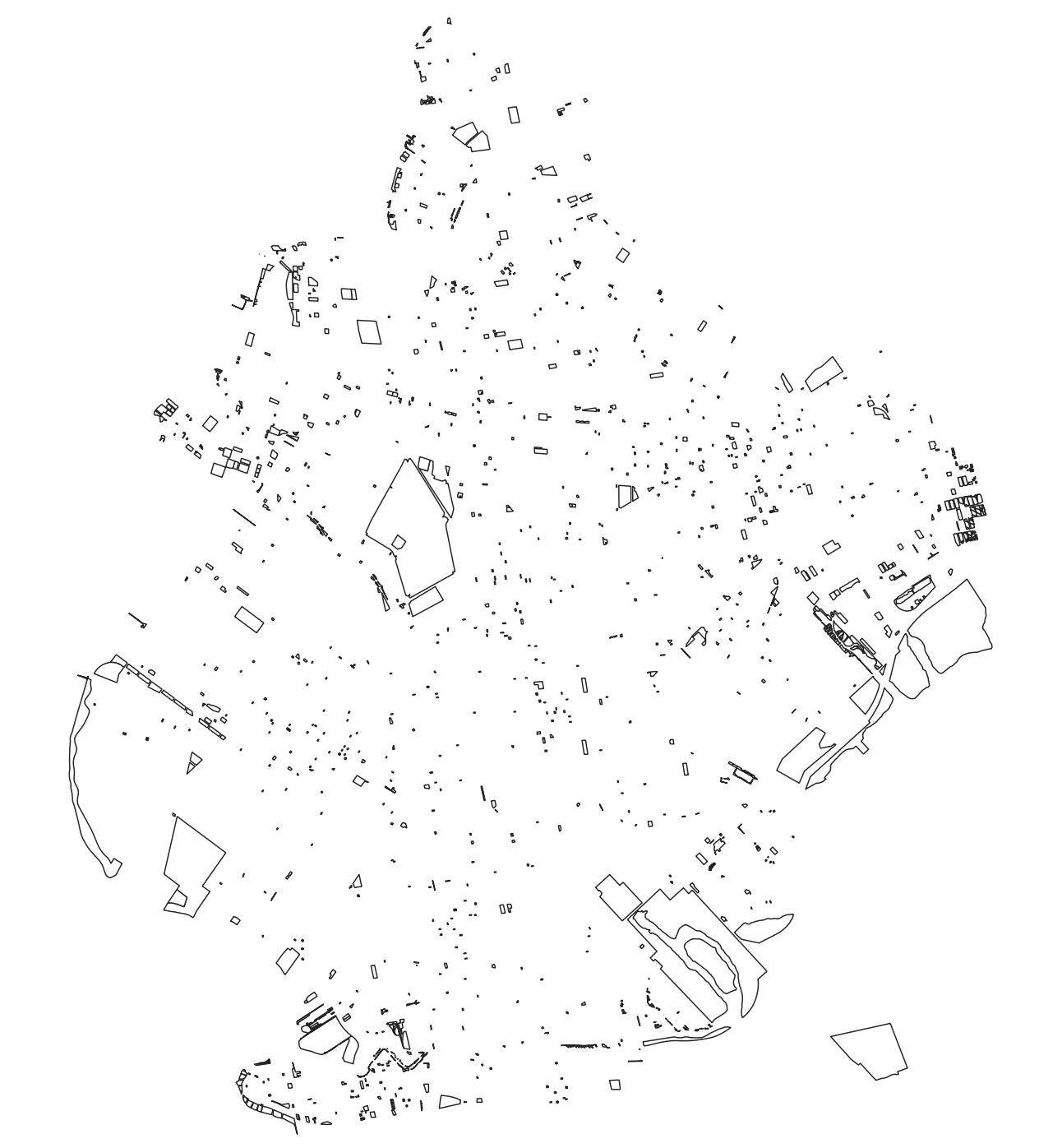
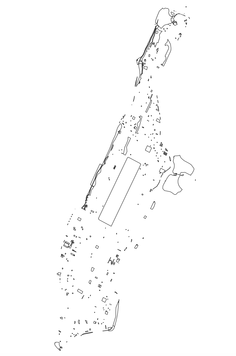
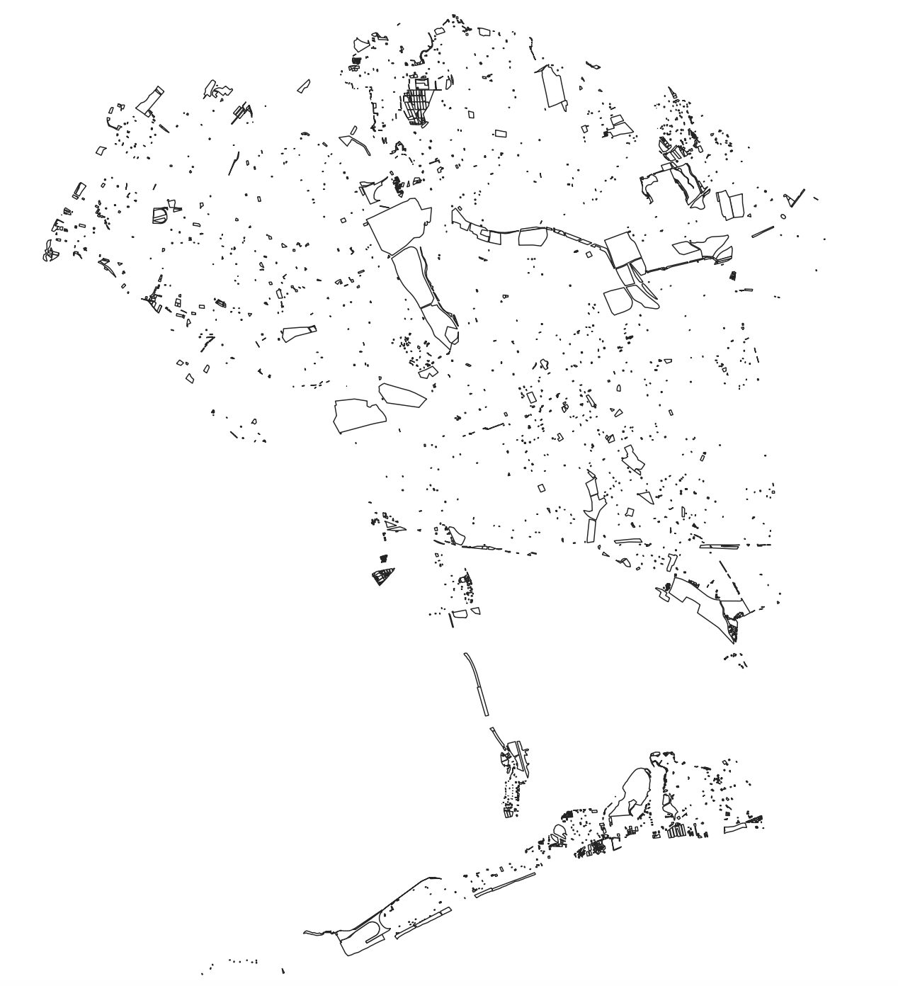
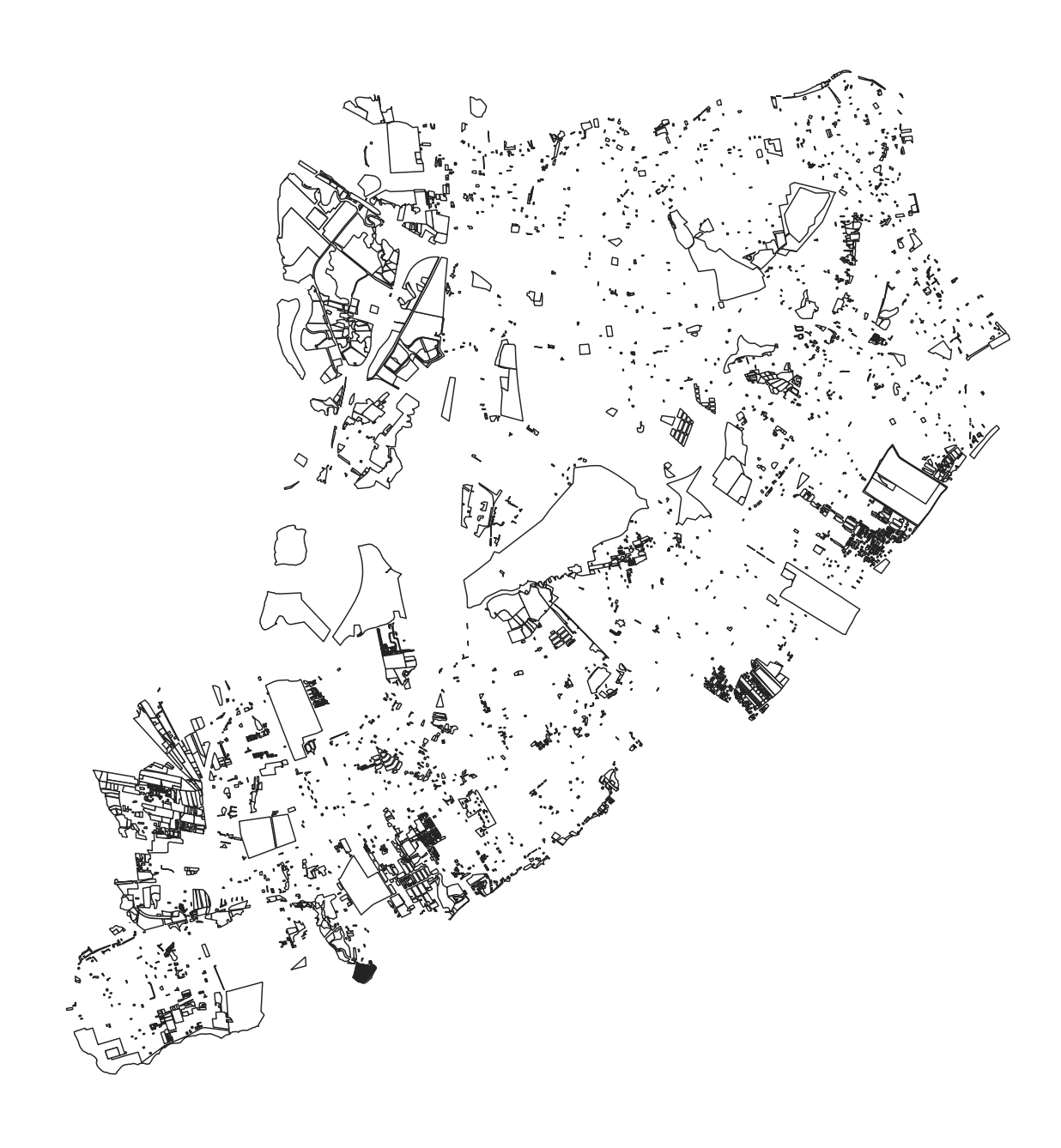
- Daily Sunlight Hours: this data took some time to compile. The goal was to perform sunlight analysis using Rhino, Grasshopper, and 3D building models of the city. I considered using OSM data, but the radius with which I could import that data into Grasshopper was not even close to large enough to run the analysis for an entire borough. Instead of risking the quality of this data, I took the published 3D models of the city's neighborhoods, joined and meshed them, and then combined them by borough. All-in-all, this process took several weeks, so to prevent anyone else from having to take that time to utilize 3D meshes of the city I have provided a link to the files below. These locations were then filtered to only include locations with 2 or more hours of estimated sunlight per day in order to ensure successful minimum yields in all plots.
- Lot Type: this data was included within the PLUTO lot dataset and is important for understanding the overall landscape of potential urban agriculture locations by land use type.
- Open Space Lost: this data was a simple calculation of the total area of the lot divided by the total area of all open spaces within the borough. It is important to note for this that I have deliberately included all parks in the city, including Central Park, Prospect Park, etc. This is not to suggest that they be converted entirely into urban agriculture, but rather that there is potential for urban agriculture within them regardless of scale.
- Proximity to Highways: this data was calculated in QGIS by using the shortest line geoprocessing tool from each lot to the nearest point on a highway. The distances of these lines were then converted into miles and joined to the original dataset.
- Proximity to Low Income Households: for this data, I first needed to join census data to census tracts and remove any census tracts not within the city's established poverty line and poverty threshold. Then, a similar process to distance to highways was performed again using shortest lines. This metric is important because food insecurity data is only one way of addressing need, and this project seeks to be comprehensive when considering all potential locations
- Proximity to Food Insecurity: food insecurity data is calculated differently based on the source of the data and the corresponding model used for assessing food access. For this project I requested the food insecurity data from Feeding America8 for New York City's census tracts and then performed the same process as I did for proximity to low income households to compile this data.
- Individuals Served: in my conversations with various urban agriculture departments, it was discussed how a single household is served by one 10" by 15" plot. Using those dimensions, as well as accounting for space needed for a shed and other necessities, I use the area of each lot to determine total individuals served. I was admittedly very modest in my calculations for this data, as I wanted to be sure not to overestimate this number.
- Potential to Serve Food Insecurity: this data was calculated by taking the total number of individuals served and multiplying that by a factor of the lot's proximity to food insecurity. For instance, if the lot is directly adjacent to food insecurity, it was estimated that 100% of the individuals served would be food insecure. It is important to note that this number is thus not a fact rather than a general estimation of an incredibly dynamic metric. It is important for it to be included for my project goals, but its limitations must be recognized and will be discussed more thoroughly further on.
At the end of this process I ended up with:
 Bronx: 1,457 locations, 6,621 acres
 Brooklyn: 1,413 locations, 4,583 acres
 Manhattan: 406 locations, 3,154 acres
 Queens: 2,642 locations, 8,425 acres
 Staten Island: 4,177 locations, 7,586 acres
Developing a Computational Tool
When considering the best format for communicating this data, I had three primary goals:
- Identify all possible locations within the city which could serve as urban farms or community gardens.
- Provide metrics on the viability of these locations in regards to both their inherent qualities and effects should they be converted to urban agriculture locations.
- Create a computational tool which empowers community members and government officials to explore each of these locations to see how urban agriculture can fit into the greater landscape of communities and better support their members.
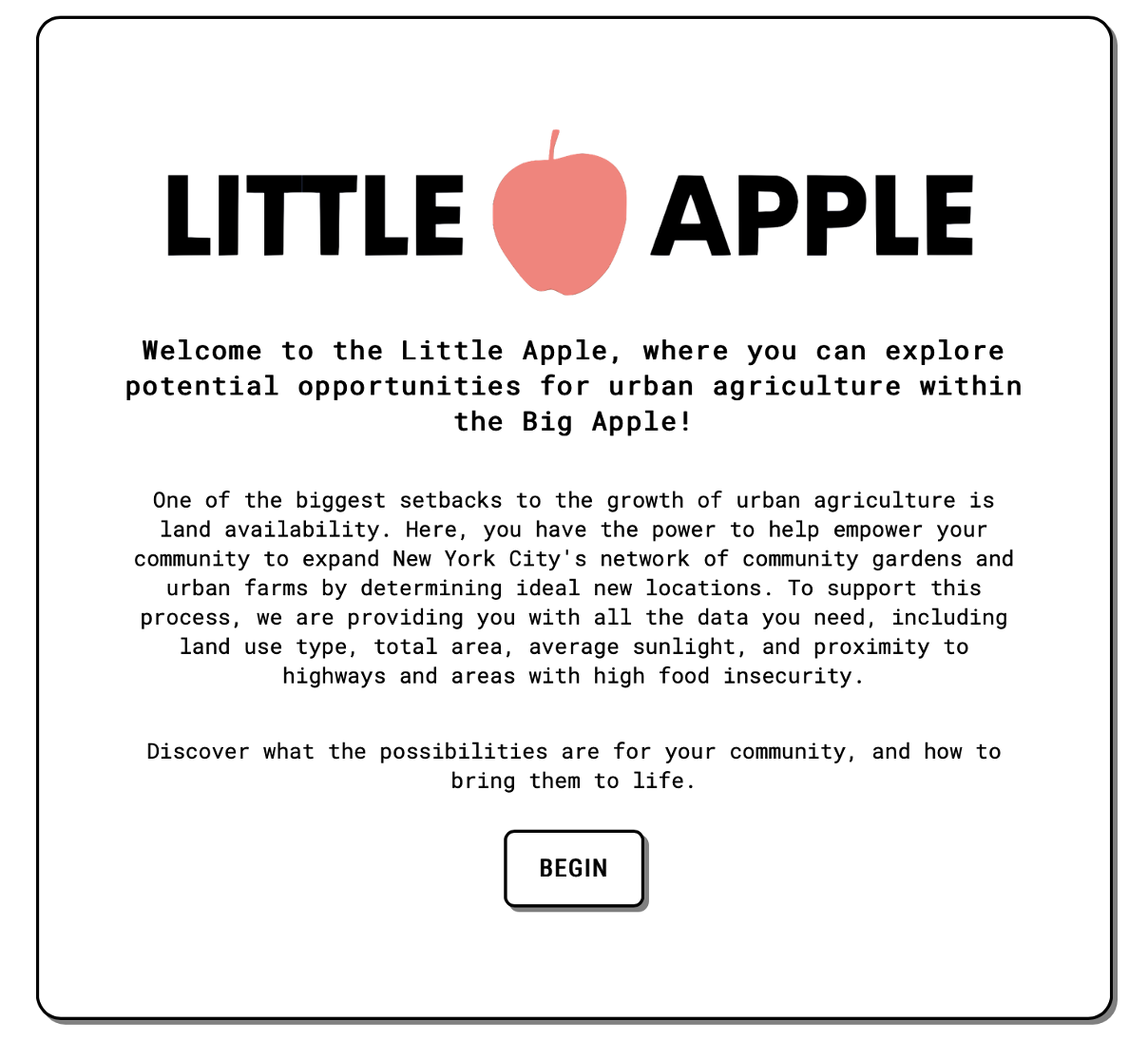
To achieve these goals, I developed a gamified computational tool called the Little Apple. This tool allows you to explore each metric yourself on a user-friendly app accompanied by exciting informational popups based on the conversations I had throughout this process.
Finally, this tool is just the beginning. When you are done exploring locations, you are able to export the full dataset of your filtered locations and further pursue their development into urban farms and community gardens.
Explore:
Limitations & Implications
Limitations
No dataset is perfect, and city-scale spatial data is a perfect example of that. The built environment is a dynamic space that cannot be categorized cleanly. For instance, what is listed as a vacant lot can also be a giant pit in the ground, as I came to find when I visited one of the potential locations on my personal list.
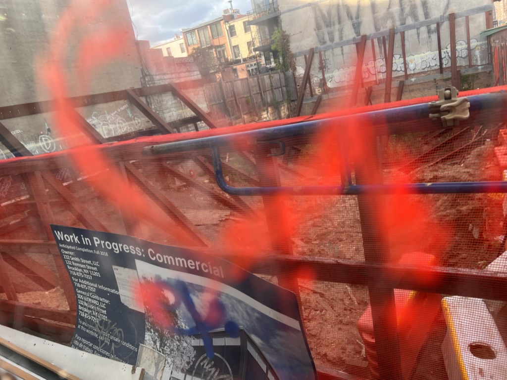
This location has been an inactive build site since before I moved to New York City. This is a perfect example of how data is a picture of one recorded moment in time, and so it needs constant updating, as will the Little Apple. There is no avoiding the immense amount of work that it would thus take to truly evaluate the possibilities for urban agriculture within the city, however that is not a reason not to do it.
In addition to limitations in the nuances of data, I mentioned above my calculation of how much each potential location addresses food insecurity. But food insecurity is just a phrase that generalizes a series of complex circumstances. Similarly, this metric is generalizing by calculating the number of individuals served relative to proximity to measured food insecurity within Feeding America data. This calculation was a series of objective decisions on my part, and as such it must be recognized as imperfect.
Finally, overall outcomes of a location are not just given the inherent possibilities within the space, but given the number of individuals who step up and get involved. It is dependent on how much a community gathers around a potential location to integrate it as a vital resource. Because I can't possibly predict the possibilities of that, it is critical to recognize that there is so much more potential than can be reflected here.
Implications
This project does not aim to present a singular solution for NYC’s food system. Rather, it seeks to support a growing urban agriculture program grounded in community action and established need. The first of its kind, this tool opens the space of spatial analysis to those who don't have the skills to otherwise explore it.
It is my hope that the results of this project will support and inspire the future of expanding urban agriculture within New York City on both a local and city-wide scale. In the future, it is my hope that this tool can be expanded to be a long-term resource for this and other cities to explore the possibilities of urban agriculture.
For these reasons, similarly to the Little Apple, I open this up to you, my neighbors and community members in New York City. I leave room within this project for contstant reconsideration, revision, and removal. I encourage anyone to reach out and help me continue to grow the Little Apple as it needs to grow in order to fit the dynamic and ever-changing and needs of this city.
Urban Agriculture Resources
While this project is focused specifically on the identification and evaluation of potential locations for urban agriculture in New York City, throughout my research I have come across several resoures that will be beneficial for individuals pursuing agriculture regardless of location. I am listing them here to accompany the work that I hope follows from the Little Apple:
USDA Urban Agriculture and Innovative Production Grants
NY State Department of Agriculture and Markets Funding Opportunities
USDA Planting Zone Map
Raised Bed Vegetable Garden Plans
plantmaps.com
Factors that influence crop yield
Google Project Sunroof
City Harvest
Feeding America
GrowNYC
Modifying The Little Apple
The Little Apple is built to be rebuilt. The framework of this app is in Vue, and as such it can be quickly and easily updated in order to visualize urban agriculture within other cities. All you will need data-wise is:
- A shapefile of all of the potential urban agriculture locations you would like to consider with corresponding metrics
- A shapefile of the unincluded surrounding boroughs so that you can limit your map to the area in question.
You can get all of the code to do expand this on my Little Apple GitHub page and transfer the data yourself, or you can reach out to me and I will be happy to help. All I ask is that if you do expand this project in any way, please reach out and share with me how you are using the Little Apple!
NYC 3D Models for Use
As I mention above, simply converting all of the neighborhood 3D models of New York City was a project on its own. These models are extremely dense, and sunlight analysis using one of them before they were meshed and joined was next to impossible, let alone conducting sunlight analysis on an entire borough. But the data needed sunlight, and so I went through the multi-week process of downloading each file, converting all of the surfaces to meshes, joining those meshes, and then combining each mesh by borough in order to create a (still very heavy) much lighter 3D file on which I could run sunlight analysis.
I don't want you to have to do the same. At this link, you can download the 3dm files for every borough in the city, as well as one file containing the buildings for the entire city. Each file is geocoded so you can easily import other data for analysis.
Sources
1City Harvest. “Food Insecurity.” Accessed March 25, 2023. https://www.cityharvest.org/food-insecurity/.
2Editor, NYC Food Policy. “Hunts Point Distribution Center: An Overview - NYC Food Policy Center.” NYC Food Policy Center (Hunter College), January 10, 2018. https://www.nycfoodpolicy.org/hunts-point-distribution-center-brief-overview-spotlight-produce-market/.
3Ourgoodbrands. “The Amazing Advantages of Hyperlocal Food Movement,” July 7, 2020. https://ourgoodbrands.com/advantages-hyperlocal-food-movement/.
4Magazine, Harlem World. “Mayor Adams Appoints Qiana Mickie As Director Of New Mayors Office Of Urban Agriculture.” Harlem World Magazine (blog), September 23, 2022. https://www.harlemworldmagazine.com/mayor-adams-appoints-qiana-mickie-as-director-of-new-mayors-office-of-urban-agriculture/.
5Cultivating Community. “Cultivating Community | Empowering People Through Food.” Accessed May 2, 2023. https://www.cultivatingcommunity.org/.
6NYC Open Data. “City-Owned Sites That Are Available and Potentially Suitable for Urban Agriculture (Local Law 46 of 2018).” Accessed May 2, 2023. https://data.cityofnewyork.us/Environment/City-owned-sites-that-are-available-and-potentiall/qchy-end3.
7“PLUTO and MapPLUTO.” Accessed May 2, 2023. https://www.nyc.gov/site/planning/data-maps/open-data/dwn-pluto-mappluto.page.
8“Map the Meal Gap Data | Feeding America.” Accessed May 2, 2023. https://www.feedingamerica.org/research/map-the-meal-gap/by-county.